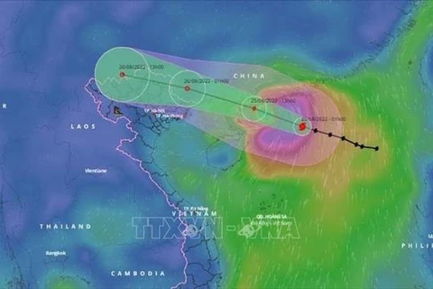
Hanoi (VNA) - Storm Maon – the third to enter the East Sea this year, further weakened into a low pressure area in the northern mountainous region on early August 26.
At 1am, the strongest wind at the centre of the low pressure area was below 39 km/h. In the next 12 hours, the area will continue to move westward and gradually dissipate.
There is a high risk of flash floods and landslides in mountainous provinces and flooding in low-lying areas such as Quang Ninh, Thai Nguyen, Lang Son, and Bac Giang.
In the capital city of Hanoi, extreme rain hit the capital on August 25 morning, causing rush-hour issues and falling trees. More bad weather is expected in the coming days
Heavy rains are forecast to continue in the northern region and some parts of the central and southern regions during the day./.
VNA


