Illustrative image (Photo: VNA)
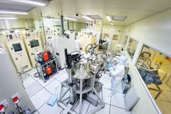
Hanoi (VNA) – Vietnam is expected to masterthe remote sensing satellite manufacturing technology under the national remotesensing development strategy to 2030 with a vision towards 2040, recentlyapproved by Prime Minister Nguyen Xuan Phuc.
The country also aims to widely apply remote sensing technologies and useremote sensing products and data in various sectors, especially in naturalresources and environmental supervision, search and rescue operations, naturaldisaster combat, and climate change response.
At the same time, Vietnam will step up international cooperation in this field,as outlined in the strategy.
The strategy also sets the target of building stations to collect and handle thedatabase on national remote sensing photos in service of socio-economicdevelopment, as well as national defence and security.
To that end, the country will perfect remote sensing-related institutions,policies, laws, and technical standards, while also enhancing state managementcapacity in this regard.
Under the strategy, data management agencies will enhance coordination as wellas information, data, and product sharing with related ministries, agencies,localities, organisations, and individuals.
Furthermore, efforts will be made to promote the use of remote sensing information,data, and products.–VNA
VNA