Vietnam to raise awareness on sea protection
A giant map of VN formed by 1,500 young people in white and blue
uniforms on the beach of Nha Trang set a new national record on June 5
as part of activities to celebrate the 2011 Sea and Islands Week (June
1-8).
A giant map of VN formed by 1,500 young people in white and blue
uniforms on the beach of Nha Trang set a new national record on June 5
as part of activities to celebrate the 2011 Sea and Islands Week (June
1-8).
The 43 metre long human map, which included the Truong Sa (Spratly) and Hoang Sa (Paracel) archipelagoes and Phu Quoc island, was formed during a meeting in the central province of Khanh Hoa to mark the Sea and Islands Week, The World Oncean Day (June 8) and the World Environment Day (June 5), drawing the participation of more than 4,000 people.
The one-week event, themed “Green brainpower for sustainable development of Vietnam ’s Sea and Islands ”, was held by the Khanh Hoa People’s Committee and Ministry of Natural Resources and Environment (MoNRE).
Speaking at the event, Deputy Minister of MoNRE Nguyen Van Duc stressed the sea acts as a gateway for Vietnam to exchange and cooperate with international friends. Therefore, the goal of developing Vietnam into a country rich and strong in sea is a strategic issue of the Party and Government.
He added, the sea plays a strategic role in national socio-economic development and called on every Vietnamese to protect its natural resources to ensure their sustainability in the wake of climate change.
Localities throughout the country held a wide range of events to mark the Sea and Islands Week, from cultural festivals, and performances, photo exhibitions to sports competitions, all on the theme of sea protection./.


You should also see
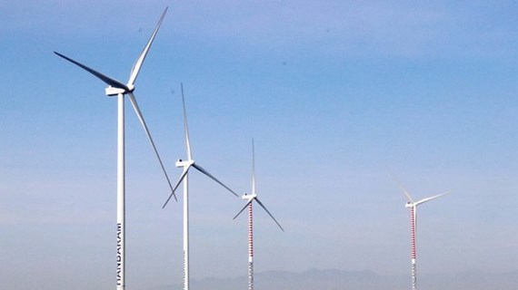
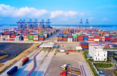
Energy industry needs nearly 5 trillion VND of investment in 2021-2030
The total investment capital demand for the whole energy sector in the 2021-2030 period is between 4.13-4.8 trillion VND (163.01-189.46 million USD), according to a plan to implement the National Power Planning in the 2021-2030 period with a vision to 2050.
See more
 Environment
Heavy showers, hail hit Lao Cai
Heavy showers accompanied by hail suddenly poured down in the northern mountainous province of Lao Cai at around 6:30pm on April 24.
 Environment
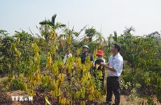
Drought at peak dry season impacts over 20,000ha of farmland
About 20,090ha of farmland and over 2,600 households have been hit by drought and water scarcity in the central region, Central Highlands, and southeastern region, which are now in the peak period of the 2023 - 2024 dry season.
 Environment
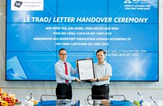
Hoa Phat steel products certified to meet greenhouse gas inventory standard
Vietnamese steel giant Hoa Phat Group has announced that BSI - the UK's leading international certification organisation - certified ISO 14064-1:2018 standard and ISO 14067:2018 on greenhouse gas inventory for steel products of its subsidiary - Hoa Phat Dung Quat Steel JSC.
 Environment
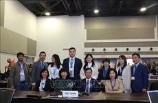
Vietnam supports global agreement on plastic pollution
A delegation of Vietnamese negotiators joined those from 176 countries worldwide at the fourth session of the Intergovernmental Negotiating Committee (INC-4) on plastic waste in Ottawa, Canada, on April 23.
 Environment
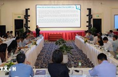
Consultation workshop on Cambodia’s Funan-Techo canal held in Can Tho
The Vietnam National Mekong Committee (VNMC) on April 23 held a consultation workshop on Cambodia’s proposed Funan-Techo canal project which has raised concerns about potential impacts on the Mekong river.