Official requests directing vessels to avoid upcoming typhoon
 Fishing vessels in Quang Tri (Photo: VNA)
 Hanoi (VNA) – Deputy head of the Central Steering Committee for Natural Disaster Prevention and Control Tran Quang Hoai has asked municipal and provincial steering committees and local border guards to call on vessels to avoid the upcoming typhoon, Conson.
During a teleconference with 14 northern mountainous provinces, ministries and agencies concerned on September 9, Hoai also urged the Health Ministry to offer detailed guidelines to areas in “red zones” in line with Directive No.16/CT-CP on COVID-19 prevention and control to make it easier for evacuation.
Speaking at the event, Deputy Director of the Vietnam Disaster
Management Authority Nguyen Van Tien required cities and provinces to continue
keeping close track of rainfalls there, raise public awareness of the complicated
movement of storms in the East Sea, instruct residents how to ensure safety and store food and
water.
Localities were also assigned to inspect unsafe houses,
residential areas at high risk, ensure the safety of water reservoirs, small
irrigation lakes and underway construction works as well as come up with plans
to protect crops.
Ministries, agencies and units concerned will deploy forces and
equipment for search and rescue upon request. At the same time, they must actively
inspect the safety of power network.
Sen. Lieut. Col Nguyen Dinh Hung, deputy head of the Border Guard High Command’s
search and rescue office, said as of September 9 morning, about 500 fishing vessels
were still operating, mostly in Quang Binh, Quang Tri, Quang Ngai and Binh Dinh, and
around Hoang Sa (Paracel) archipelago.
According
to the Office of the Central Steering Committee for Natural Disaster Prevention
and Control, several localities reviewed evacuation plans in case of heavy
storm and widespread rainfalls.
At 1pm on September 9, the storm, the fifth to hit the country so far this year, was about 540km east southeast of Hoang Sa archipelago, with the wind speed of up to 75-90km per hour.
It is forecast that in the next 24 hours, the storm will move to the west at about 15km per hour and is likely to get stronger, with the strongest wind in the area near its center predicted at 90-115km per hour at 1pm on September 10./.


You should also see
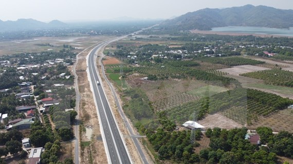
Cam Lam - Vinh Hao Expressway to help drive south-central region's economy


See more
 Society
Documents, artifacts related to Dien Bien Phu Campaign unveiled in Yen Bai
 Society
French court to hold hearing on AO lawsuit
 Society
Kon Tum culinary contest honours 120 dishes from local ginseng
 Society
VNA honors journalistic excellence at 2023 Press Award ceremony
 Videos