Remote sensors to help monitor marine resources
The National Remote Sensing Department under the Ministry of Natural
Resources and Environment is working with the Vietnam Administration of
Seas and Islands on a project designed to monitor sea and island
resources using remote sensing technology.
The National Remote Sensing Department under the Ministry of Natural
Resources and Environment is working with the Vietnam Administration of
Seas and Islands on a project designed to monitor sea and island
resources using remote sensing technology.
The project, which is a part of a master plan to survey and manage marine environment resources with a vision to 2020, aims to develop a basic database on the country's marine resources and environment.
According to the head of the National Remote Sensing Department, Nguyen Xuan Lam, the department had established a system of topographical maps of the Hoang Sa (Paracel) and Truong Sa (Spratly) archipelagos, and was building a database to draw up a map on a 1:50,000 scale of the land covering coastal areas and emerging islets.
The department has also drawn a collection of specialised maps on a 1:1,000,000 scale accompanied by data on the physical, chemical and biological factors of the area around Vietnam's territorial waters, while setting up a multi-temporal monitoring system using remote sensors and geo-information technologies.
The initial results have opened up prospects for the country to enhance its future application of remote sensing technology in the exploration and monitoring of its maritime and island resources.-VNA


You should also see

Vuong Dinh Hue permitted to cease holding positions, working
The 13th Party Central Committee on April 26 agreed to let Vuong Dinh Hue cease holding the positions of Politburo member, member of the 13th Party Central Committee, and Chairman of the 15th National Assembly (NA) in the 2021 - 2026 tenure.


See more
 Environment
Heavy showers, hail hit Lao Cai
Heavy showers accompanied by hail suddenly poured down in the northern mountainous province of Lao Cai at around 6:30pm on April 24.
 Environment
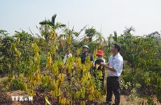
Drought at peak dry season impacts over 20,000ha of farmland
About 20,090ha of farmland and over 2,600 households have been hit by drought and water scarcity in the central region, Central Highlands, and southeastern region, which are now in the peak period of the 2023 - 2024 dry season.
 Environment
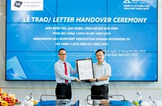
Hoa Phat steel products certified to meet greenhouse gas inventory standard
Vietnamese steel giant Hoa Phat Group has announced that BSI - the UK's leading international certification organisation - certified ISO 14064-1:2018 standard and ISO 14067:2018 on greenhouse gas inventory for steel products of its subsidiary - Hoa Phat Dung Quat Steel JSC.
 Environment
Vietnam supports global agreement on plastic pollution
A delegation of Vietnamese negotiators joined those from 176 countries worldwide at the fourth session of the Intergovernmental Negotiating Committee (INC-4) on plastic waste in Ottawa, Canada, on April 23.
 Environment
Consultation workshop on Cambodia’s Funan-Techo canal held in Can Tho
The Vietnam National Mekong Committee (VNMC) on April 23 held a consultation workshop on Cambodia’s proposed Funan-Techo canal project which has raised concerns about potential impacts on the Mekong river.