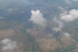
Hanoi (VNA) - Currently, remote sensing data has become a vital source of information for various fields, including mapping, natural resource investigation and management, environmental monitoring and protection, disaster prevention, urban and regional planning, scientific research and technology development.
In Vietnam, remote sensing technology has been actively applied in natural resource management, focusing on land, water, minerals and forest resources, as well as environmental monitoring.
Additionally, the natural resources and environment sector is gradually expanding the application of remote sensing technology for unified management and monitoring of natural resources and the environment across the country.
While there are still challenges for the use of remote sensing technology for environmental observation and monitoring, the general trend of the era, and the urgent need to protect the environment, the sector is resolve to expand the use of the technology in managing and protecting the environment in Vietnam.

In recent years, numerous projects implemented by the National Remote Sensing Department have delivered positive results.
An example is a project using remote sensing and GIS technology to develop a database and create maps of pollution and wastewater areas in industrial zones and urban areas, helping timely issue warnings on high-risk areas in key economic regions of central.
The agency also implemented a project monitoring key waters and offshore islands, and another on monitoring coastal erosion in key areas in central Vietnam using remote sensing technology, yielded crucial outcomes.
Notably, the project monitoring marine and island resources has, for the first time, created a comprehensive and detailed map of the nation's maritime and island resources. Modern remote sensing technology has allowed the collection of information across large areas, in multiple timeframes, with exceptional speed and accuracy.

According to Hung, Vietnam can reduce technological gaps by harnessing global knowledge through research collaboration and technology transfer in remote sensing technology development.
He said it is essential to clarify priority technologies in remote sensing research and development.
Hung said his department is continuing to propose targeted research initiatives, focusing on providing a scientific basis, improving policy mechanisms, and developing legal frameworks to support state management of remote sensing activities.
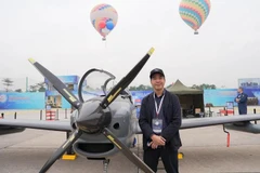
From now until 2030, Vietnam aims to master the technology for manufacturing remote sensing satellites, systems for receiving and processing satellite data, satellite control stations, and aerial Earth imagery systems using drones and balloons.
The goal is to develop a national satellite imagery database and data processing system to meet socio-economic, defence and security needs./.

