Jakarta (VNA) - Indonesia’s Meteorology, Climatology and Geophysics Agency (BMKG) recorded two earthquakes with magnitudes above 5.0 in North Maluku and Gorontalo provinces on December 20 and 21, with analyses confirming no tsunami risks.
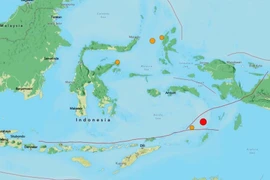
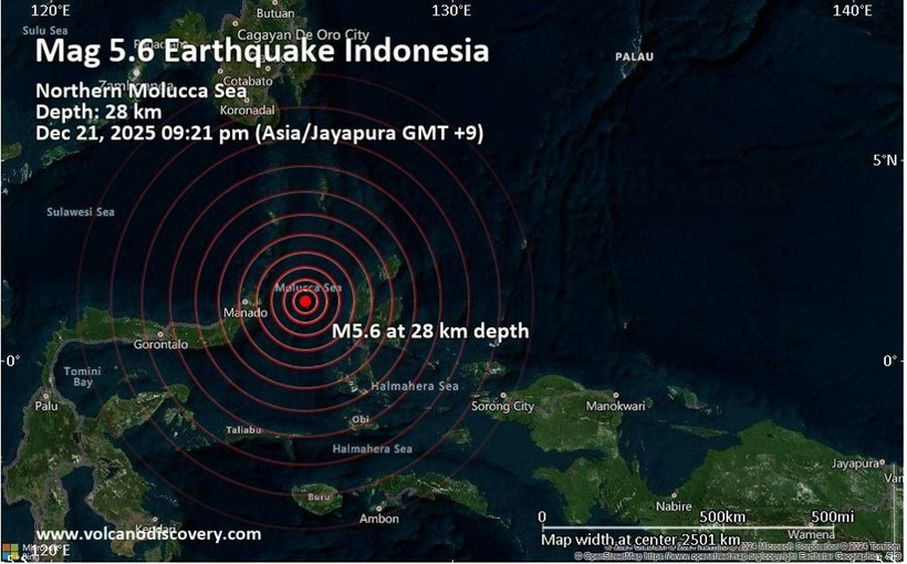
At 9:21 on December 21 (local time), a 5.6-magnitude earthquake struck the Ternate area in North Maluku province. The epicentre was located offshore, about 132 km northwest of Jailolo, at a depth of 30 km. The quake was caused by rock deformation along the Maluku Sea tectonic plate, with a reverse faulting mechanism.
The tremor was felt in several areas, including Manado, Bitung, Minahasa and Tomohon. A 3.0-magnitude aftershock was recorded shortly after the main quake.
A day earlier, a 5.2-magnitude earthquake hit Pohuwato district in Gorontalo province. The epicentre was located at a depth of 108 km, and the quake resulted from internal deformation within the Sulawesi Sea tectonic plate. Although the epicentre was on land, its moderate depth helped limit potential damage, and no tsunami threat was detected.
Daryono, Director of the BMKG’s Earthquake and Tsunami Centre, urged the public to remain calm and rely only on official information sources. As Indonesia lies within a highly active tectonic zone, residents are advised to stay vigilant and be well prepared for natural disasters./.