Hanoi (VNA) – The Philippines has been bracing for heavy rainfall as two low-pressure areas may develop into tropical depression, the state-run weather bureau PAGASA reported on July 23.
According to the bureau, the low-pressure system was located about 115km northwest of Laoag city, Ilocos Norte province, moving west-southwest at 35 km/h. It is forecast to briefly enter the East Sea later on July 23 before veering northeast toward waters east of Taiwan (China), bringing heavy rain to several northern provinces. The system is expected to have minimal impact on Vietnam.
Meanwhile, a storm called Francisco, located 900km east of northern Luzon as of 10 am, is moving northward with sustained winds of 65 km/h and gusts up to 80 km per hour. It is expected to exit the Philippine area of responsibility by July 24 and head toward northern Taiwan.
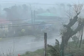
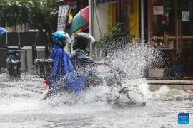
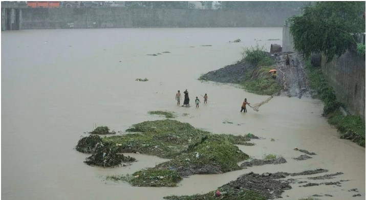
The presence of both systems is intensifying southwest monsoon winds, exacerbating conditions in areas still reeling from the impact of Typhoon Wipha. Many districts in Manila remain submerged or are recovering from mudflows, with over 70,000 people evacuated, more than 23,000 from riverside areas alone during the night of July 22.
The National Disaster Risk Reduction and Management Council confirmed at least six fatalities and several missing. Floodwaters persist in parts of Manila, Pasig, Quezon, and Caloocan, where residents are using makeshift rafts to move through submerged streets.
Authorities continue to urge vigilance, particularly in low-lying and riverside areas at risk of flash floods and landslides in the coming days./.