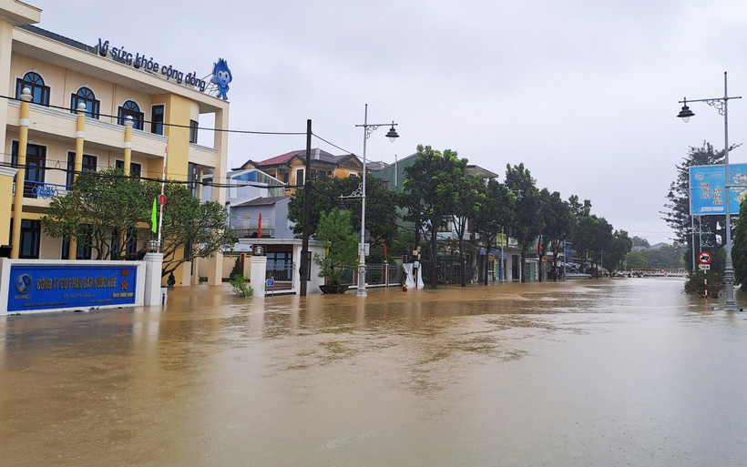
Da Nang (VNA) - Floodwaters along the Vu Gia–Thu Bon river system in the central city of Da Nang surpassed the highest flood warning level (Level 3) on the night of October 27 and the early morning of October 28.
Some areas may experience flooding levels exceeding the historic 2007 flood, according to the Central Hydro-meteorology Station under the Vietnam Meteorological and Hydrological Administration.
The risk of flood-related natural disasters has been raised to Level 3, the station reported.
Water levels at most monitoring stations along the Vu Gia–Thu Bon rivers have already exceeded Level 3. The peak of the flood was expected to occur between 7:00pm on October 27 and 7:00am on October 28, reaching potentially dangerous levels.
At the Giao Thuy station on the Thu Bon river, water levels have reached 10 meters, which is 1.2 meters above Level 3, matching the peak of the 2007 flood and 0.3 meters higher than the flood in 2017. On the Tien river, the water level is 1.2 meters above Level 3. In Hoi An, the water level is 1.1 meters above Level 3, while that on the Tam Ky river is nearing the Level 1 warning threshold.
Over the next 12 to 24 hours, floodwaters in the Vu Gia–Thu Bon river system are expected to recede slowly but will likely remain at or above the Level 3 warning.
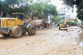
The meteorological agency has issued a warning of prolonged and widespread flooding in low-lying and riverside areas, with severe inundation expected in urban zones. There is also a high risk of flash floods and landslides in the mountainous areas of Da Nang city./.