Ca Mau (VNA) – Twenty-one coastal provinces and cities nationwide have protected more than 281,000ha of forests after five years of implementing a Government scheme on protecting and developing coastal forests, meeting 102% of the scheme’s target.
Under the scheme “Protecting and developing coastal forests in response to climate change and promoting green growth in the 2021–2030 period”, these localities have also planted more than 11,600ha of new and restored forests, including more than 7,700ha of mangrove and nearly 4,200ha of wind- and sand-shielding protection forest, the Ministry of Agriculture and Environment reported at a recent conference held in the southernmost province of Ca Mau to review the implementation of the scheme.
Among these localities, Ca Mau led with 1,879ha of newly planted forest, reaching 93.3% of the target.
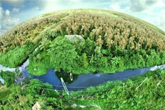
Speaking at the conference, organised by the ministry, the Ca Mau People’s Committee and the World Wide Fund for Nature (WWF) – Vietnam, Phan Minh Chi, Deputy Director of the provincial Department of Agriculture and Environment, said Ca Mau is home to precious internationally recognised wetland ecosystems and has the largest mangrove ecosystem in the country.
Mangrove forests act as a “green shield” against erosion and sea-level rise, while providing sustainable livelihoods for local people, he said.
“Therefore, Ca Mau always sees environmental protection and livelihood development as inseparable and is committed to strict forest management, while seeking support in resources and technical solutions to develop sustainable livelihood models and help achieve the scheme’s targets,” he said.
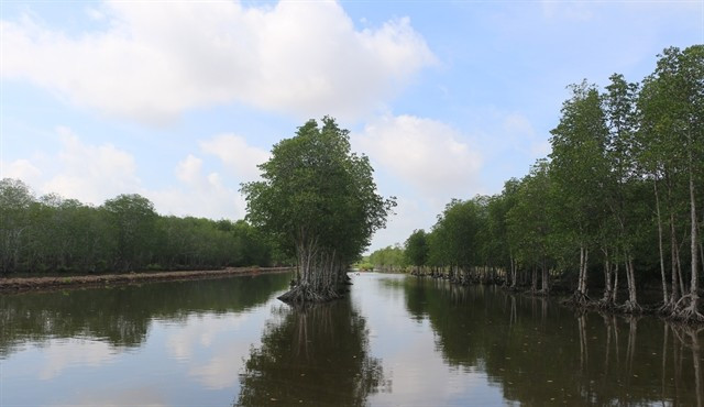
Ca Mau has more than 148,000ha of forests and forestry land, including more than 102,000ha of mangrove forests, which are the heart of the coastal ecosystem.
During 2021–2025, coastal provinces and cities nationwide have implemented 147 projects for coastal forest protection and development, along with sea dykes, soft wave-break structures, watch towers and patrol roads. The projects cost more than 2.6 trillion VND (98.8 million USD).
Among these projects, several livelihood models have been implemented for coastal communities.
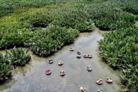
Specifically, the project “Enhancing the resilience to climate change impacts of vulnerable coastal communities in Vietnam” has supported 46 models, including intercropping with agricultural plants, aquaculture and honey-bee farming.
Climate change continues to cause sea-level rise, severe erosion, and strong storms. These factors, in combination with saltwater intrusion and pest damage, reduce tree survival rates on weak soil areas and create localised forest loss, according to participants at the conference.
Human factors, including forest land encroachment for aquaculture, plastic waste and polluted coastal water, also pose serious obstacles.
In response, local representatives proposed several solutions at the conference.
Le Sy Duong, deputy head of Ninh Binh province’s Forestry and Forest Protection Sub-department, proposed stronger communication efforts, scientific planning of mangrove ecosystems, strict action against deforestation and sustainable tourism development.
Hua Chien Thang, deputy head of Vinh Long province’s Forest Protection and Biodiversity Sub-department, called for timely technical guidance to control harmful organisms in mangrove forests.
In the Mekong Delta, which is most affected by climate change, coastal forests play a vital role in green-growth goals.
Ca Mau province is also the delta locality where natural challenges are most visible.
Despite efforts to plant and restore thousands of hectares of forests, severe erosion along both Ca Mau’s eastern and western coasts is swallowing about 300ha of forests each year.
Alongside natural disasters, officials attending the conference also mentioned that land for forest planting is shrinking and fragmented, while many areas must create artificial mud flats, which results in very high investment costs. Environmental pollution and coastal waste are also directly threatening the growth of mangrove forests.
The Ministry of Agriculture and Environment's scheme for 2026–2030 aims to maintain existing forests, and restore and develop over 23,300ha of forest, including 13,500ha of new planting and 9,800ha of restored ones. However, coastal provinces and cities currently plan to plant only 6,602ha, far below requirements.
The ministry asked coastal provinces and cities to focus on site surveys, selecting suitable tree species, complying with planting seasons, and applying silvicultural techniques to raise forest establishment rates.
It also urged the expansion of mixed farming-forestry-fishery models and livelihood support for communities to improve forest protection outcomes./.
VNA