Vietnam pioneers use of AI and remote sensing to monitor seawater quality

According to Dr. Vu Anh Tuan, Deputy Director General of the Vietnam Space Centre and head of the project, this is the first study in Vietnam to simultaneously employ Sentinel-2 satellite data, advanced machine learning algorithms, and the Google Earth Engine (GEE) cloud computing platform to model and monitor key seawater quality parameters.

The research team collects seawater samples in Ha Long Bay and Cua Luc. (Photo: VNA)

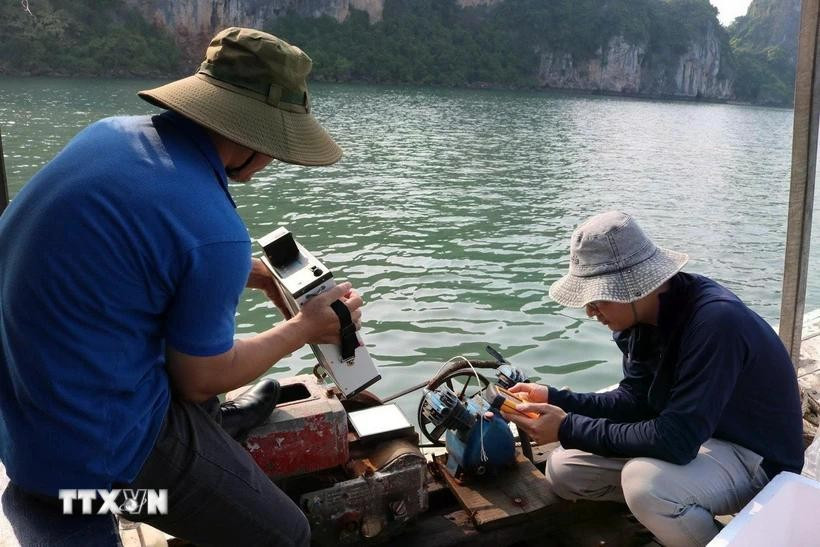
Hanoi (VNA) - Vietnam has, for the first time, applied artificial intelligence (AI) and and remote sensing technologies to monitor seawater quality through a joint research initiative with Polish scientists, marking a significant step forward in enhancing environmental management and water resource governance in key coastal regions.

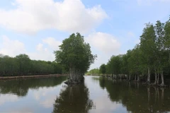
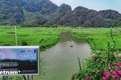
Rapid socio-economic development in recent years has led to growing environmental challenges in areas like Ha Long Bay and Cua Luc of Quang Ninh province, particularly the degradation of seawater quality, which threatens unique marine ecosystems. Traditional monitoring methods such as on-site sampling and laboratory analysis have proven to be costly, time-consuming, and limited in coverage.

In response, researchers from the Vietnam Space Centre under the Vietnam Academy of Science and Technology and the Institute of Geophysics of the Polish Academy of Sciences have developed an innovative, cost-effective approach using AI and satellite imagery. This modern method allows for continuous, large-scale seawater monitoring.

A modern and integrated approach

According to Dr. Vu Anh Tuan, Deputy Director General of the Vietnam Space Centre and head of the project, this is the first study in Vietnam to simultaneously employ Sentinel-2 satellite data, advanced machine learning algorithms, and the Google Earth Engine (GEE) cloud computing platform to model and monitor key seawater quality parameters.

Using this model, the research team created spatial-temporal maps of water quality, enabling early detection of pollution risks and long-term trend analysis in Ha Long Bay and Cua Luc. These maps serve as valuable tools for water resource management, environmental protection, and sustainable coastal development planning.

Dr. Tuan emphasised the novelty of the study lies in its creative and integrated use of remote sensing, AI, and cloud computing technologies to address the complex issue of marine water quality. The research overcame challenges such as data scarcity and provided high-value, practical insights.

The machine learning models were calibrated and validated to achieve over 73% accuracy. Seasonal and annual maps of water quality indicators were also developed, offering a comprehensive view of changes over time.

Beyond its immediate findings, the study paves the way for broader applications of remote sensing and machine learning in environmental monitoring, especially in areas facing resource constraints.

Toward nationwide deployment

Encouraged by promising results, the research team plans to expand the model's application to coastal ảeas across Vietnam. While each marine area presents unique characteristics, the study’s foundational framework can be adapted to ensure accurate and region-specific results.

Ultimately, the team envisions a comprehensive monitoring system capable of continuously tracking seawater quality parameters nationwide. This system would provide essential data for planners and policymakers, issue timely warnings about environmental risks, and support key sectors such as aquaculture and marine-based economies.

Associate Professor Dr. Pham Quang Vinh, a member of the evaluation council under the Vietnam Academy of Science and Technology, lauded the research as a strong example of integrating AI with remote sensing for coastal water studies. He noted that the project’s findings, published jointly by the Vietnamese and Polish sides in a high-ranking SCIE Q1 international journal, highlight the success of scientific collaboration between the two nations./.

VNA

See more

Air pollution in Hanoi. (Photo: VNA)

Hanoi to launch 5,000 public electric bicycles

In a move to reduce air pollution and promote green mobility, Hanoi has approved a plan to deploy 5,000 public electric bicycles, alongside restrictions on petrol- and diesel-powered vehicles in the city’s central area.

Official heritage plaque i sinstalled on the 12 recognised Shan Tuyet tea trees in Dong Phuc commune. (Photo: VNA)

Thai Nguyen: 12 ancient Shan Tuyet tea trees win national heritage status

The recognition honours the biological, cultural and historical values of these centuries-old Shan Tuyet tea trees – natural treasures deeply woven into the livelihoods, traditions and identity of local ethnic communities. The title affirms the community’s commitment to preserving and promoting the value of this iconic local tea variety.

Sarus cranes at Tram Chim National Park (Photo: VNA)

Return of sarus cranes: Hope takes wing in Dong Thap wetland

Beneath the wide Mekong Delta sky, Tram Chim National Park is racing against time, pouring heart and science into a decade-long (2022–2032) plan to rescue the Eastern sarus crane – an elegant, scarlet-headed bird listed as endangered on the International Union for the Conservation of Nature (IUCN) Red List and a living emblem of both the park and all of Dong Thap province

French Ambassador Olivier Brochet speaks at the press conference in Hanoi on December 11 to mark the 10th anniversary of the Paris Agreement on climate change and highlighting the COP30 outcomes. (Photo: VNA)

International community ready to support Vietnam in energy transition, climate response

In a video message to the press conference, UN Resident Coordinator in Vietnam Pauline Tamesis said the UN is ready to support Vietnam in building a pipeline of projects capable of absorbing financing mobilised under the Political Declaration on establishing the Just Energy Transition Partnership (JETP), as well as from global climate finance sources, including the Green Climate Fund and the Loss and Damage Fund.

Forest rangers in Son La province apply technological devices and software to forest management, monitoring, and protection. (Photo: nhandan.vn)

Digital technology application enhances forest management, protection

With a total forest area of over 14 million hectares, including more than 10 million hectares of natural forests, forests exist in all 34 provinces and cities across the country. Given the large area and limited workforce, applying digital solutions in forest management and protection has become a top priority for the forestry sector.

Sunda pangolins (Manis javanica), also known as the Javan pangolin, are listed in Group IB – critically endangered and strictly protected from all commercial exploitation (Photo: VNA)

Quang Ngai releases rare pangolin back into nature

Initial verification showed that the animal weighed 3.7kg and measured over 60cm. It was identified as a Sunda pangolin (Manis javanica), also known as the Javan pangolin, listed in Group IB – critically endangered and strictly protected from all commercial exploitation.

Residents of Tuyen Quang province take part in the One Billion Trees Programme. (Photo: VNA)

Tree-planting programme exceeds one-billion-tree goal

The total comprises 573.9 million scattered trees and 865.2 million trees grown in concentrated plantations, equivalent to 429,125 hectares of forest. Provinces posting the strongest results include Phu Tho with 177.9 million trees, Lao Cai with 108.8 million, and An Giang with 98.5 million.

Construction activity is one of the causes of air pollution in Hanoi. (Photo: VNA)

Hanoi takes urgent measures to curb air pollution

The city requires the enhanced application of advanced technologies and remote monitoring systems, including satellite remote sensing, drones, and AI-integrated traffic cameras, to monitor, detect, and strictly address the illegal burning of garbage, straw, and agricultural by-products.