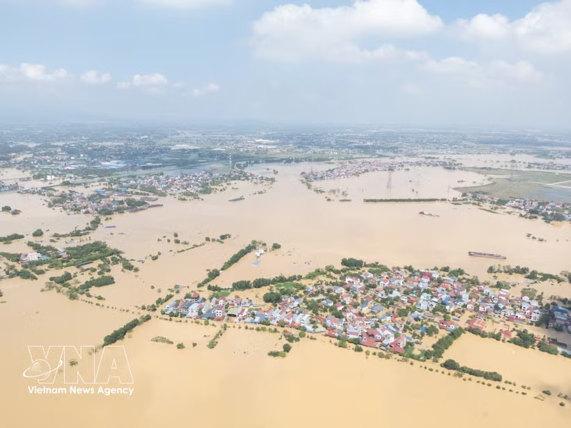
Hanoi (VNA) – Rising water levels in the Cau, Tich and Bui rivers have flooded and isolated several areas on the outskirts of Hanoi, with nearly 1,500 people cut off in Trung Gia commune and floodwaters spilling over low sections of the Bui 2 dyke in Xuan Mai commune.
According to Hanoi’s Civil Defence Command, the Tich River level at the Kim Quan station reached 8.42m at 6:40pm on August 24, 0.02m above the Level-3 flood warning threshold. The city issued a Level-III flood alert and asked local authorities and relevant forces to implement response measures.
In Trung Gia commune, 338 households with 1,489 people were isolated as of August 24. Floodwaters also submerged about 50ha of rice and other crops.
In the commune’s Hoa Binh hamlet, residents moved livestock, poultry, motorbikes and valuable belongings to higher ground as the Cau River rose rapidly. By the afternoon of August 24, floodwaters in many riverside areas were 2–4m deep, cutting off roads. Boats became the only means of reaching flooded areas.
Authorities in Trung Gia commune have maintained 24-hour monitoring of water levels and prepared plans to evacuate residents and provide food, clean water and medicine if necessary. They have also coordinated with irrigation and power agencies to operate drainage pumps and protect the dyke system.
Meanwhile, in the Bui River basin, water began spilling over several low sections of the Bui 2 dyke in Xuan Mai commune on the afternoon of August 24, threatening residential areas and farmland behind the dyke.
The commune mobilised more than 150 people, including local disaster response forces and residents, to reinforce the dyke. More than 500 cubic metres of sand, 10,000 sandbags and other materials were prepared for the work.
The 2.8km Bui 2 dyke, with a typical elevation of 6.7– 7m, helps protect residential areas in Tien Tien, Nam Phuong and Viet An hamlets from flooding. The dyke suffered three slope erosion sites, totalling about 50m, during floods in 2025.
Authorities are maintaining patrols along the dyke, especially at low sections and locations prone to erosion, and are ready to reinforce them as water levels rise.
On the Tich River, water levels also rose rapidly. At 6pm on August 24, the level at Kim Quan reached 8.4m, equal to the Level-III warning threshold, while the level at the Vinh Phuc station was 7.93m, just 0.07m below the threshold.
The Hydro-Meteorological Centre for the Northern Region forecast that the Tich River will continue rising over the following 12–24 hours, putting many riverside communes and wards at risk of flooding, particularly low-lying residential and agricultural areas.
Authorities warned that flooding could affect residents, agriculture, aquaculture, transport and daily activities while landslides are also possible in vulnerable areas.
Hanoi’s suburban localities are continuing to closely monitor river levels, maintain emergency forces, inspect dykes and prepare plans to support residents in flooded and isolated areas./.