Hanoi (VNA) - Storm Kalmaegi has intensified and is moving towards the central East Sea, according to the National Centre for Hydro-Meteorological Forecasting.
At 1:00 on November 3, the storm’s centre was located at around 11.2 degrees North latitude and 129.7 degrees East longitude, over the waters east of central Philippines, with maximum sustained winds of Level 11 (103–117 km/h) and gusts up to Level 14. It is moving westward at about 30 km/h.
By 1:00 on November 4, the storm is expected to remain over the eastern waters of central Philippines, with winds strengthening to Level 12 and gusts up to Level 15, moving westward at around 20 km/h.
By 1:00 on November 5, it will be over the western waters of central Philippines with sustained winds of Level 12, gusts up to Level 15, and moving west-northwest at 20–25 km/h. The affected area will include the eastern part of the central East Sea, with a disaster risk level of 3 (extremely dangerous).
By 1:00 on November 6, Kalmaegi is forecast to reach the central East Sea with maximum sustained winds of Level 13, gusts up to Level 17 (highest level), and continue moving west-northwest at about 20 km/h. The affected area includes the central East Sea, including the Trường Sa (Spratly) Archipelago. The disaster risk level remains at 3.
Over the next 72–120 hours, the storm is expected to continue moving west-northwest at 20–25 km/h and may strengthen further.
From the afternoon of November 4, strong winds of Level 6–7, later increasing to Level 8–9, are expected in the eastern part of the central East Sea. Near the storm’s centre, winds may reach Level 10–12 with gusts of Level 14–15, causing waves 5–7 metres high and very rough seas.
Between November 5 and 6, the central East Sea (including the Truong Sa Archipelago) and offshore waters from Da Nang city to Khanh Hoa province are likely to experience winds of Level 12–14, gusts above Level 17, waves 8–10 metres high, and extremely rough seas. All vessels and offshore operations in these areas will be exposed to dangerous squalls, gales, and high waves.
At sea, the Gulf of Tonkin will have northeasterly winds of Level 6–7, gusts up to Level 8, waves 2–3.5 metres high and rough seas. The northern part of the East Sea will have winds of Level 6–7, gusts up to Level 9, and waves 3–5 metres high.
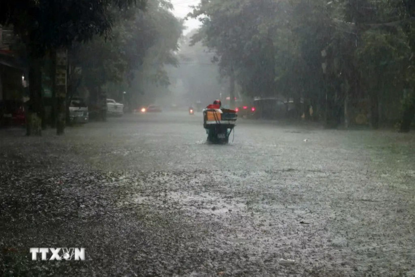
Heavy rains may cause flash floods, landslides and flooding in low-lying areas.
Heavy rain from Nghe An province to Quang Ngai province
From early November 3 to late November 4, areas from Ha Tinh to Da Nang and eastern Quang Ngai are expected to experience very heavy rainfall — 200–300mm on average, and up to 600mm in some places. Areas in Ha Tinh province, the northern part of Quang Tri province, and the eastern part of Quang Ngai province may see 100–200mm of rain, with localised totals exceeding 350mm.
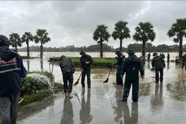
Floods on the Vu Gia–Thu Bon river system continued to rise on November 3 and remained above Level 3. Meanwhile, flood levels on the Huong and Bo rivers stayed just below Level 3 (extremely dangerous).
At 6:00 on November 3, water levels on major rivers in Hue city continued to rise, reaching or exceeding level 3. The Huong River at Kim Long Station measured 3.54 metres, 0.04 metres above Level 3; the Bo River at Phu Oc Station reached 4.50 metres, equal to Level 3; and the O Lau River at Phong Binh Station stood at 2.20 metres. Authorities warned that water levels were increasing rapidly, posing a high risk of flooding and landslides in low-lying and riverside areas.
Floodwaters are expected to recede gradually over the next 12–24 hours but may rise again between November 4 and 5 across rivers in provinces of Ha Tinh, Quang Tri and Quang Ngai, with levels reaching or exceeding Level 3 in some areas.
Authorities warn of high risks of flash floods, landslides, and severe flooding in low-lying urban and agricultural areas from Ha Tinh province to Quang Ngai province./.

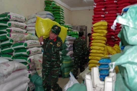
Party chief urges swift post-flood recovery in Hue
The Party chief praised the city’s rapid and decisive response to severe flooding, citing it as proof of the effective two-tier local administration model. He spotlighted the use of digital technology for transparent, real-time information and early warnings, alongside robust community solidarity in disaster response.