Typhoon Narra changes course, heads toward waters east of Bach Long Vi special zone

The Gulf of Tonkin, including Bach Long Vi, Van Don, Co To and Cat Hai special zones and Hon Dau island, as well as coastal areas of Quang Ninh and Hai Phong, will be affected. The disaster risk level is forecast at Level 3.

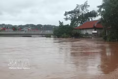
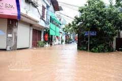
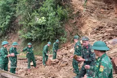
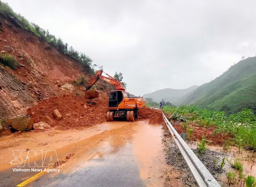
Authorities in Ba Che commune, Quang Ninh province on August 23 urgently clear mud and debris, level landslide-affected areas and clear flooded roads to help residents resume normal life soon after floodwaters receded (Photo: VNA)

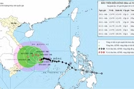
Hanoi (VNA) – Typhoon Narra, the fourth to hit Vietnam this year, has changed course again and is moving southeast towards waters east of Bach Long Vi special zone in northern Quang Ninh province while maintaining its strength, according to the National Centre for Hydro-Meteorological Forecasting.

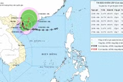
At 1:00 pm on August 23, the typhoon’s centre was about 155km east-southeast of Quang Ninh province and 150km east of Hai Phong city. It was packing winds of force 8-9, with gusts of force 10-11, and moving southeast at about 3km/h.

By 1:00 pm on August 24, it is forecast to move south-southeast at about 3km/h. Winds near the centre are expected to reach force 9, with gusts of force 11.

The Gulf of Tonkin, including Bach Long Vi, Van Don, Co To and Cat Hai special zones and Hon Dau island, as well as coastal areas of Quang Ninh and Hai Phong, will be affected. The disaster risk level is forecast at Level 3.

By 1:00 pm on August 25, the storm is expected to move east-northeast at 3-5km/h over the eastern Gulf of Tonkin, about 160km east of Bach Long Vi, with winds of force 9 and gusts of force 11.

The centre said the Gulf of Tonkin and coastal waters of Quang Ninh and Hai Phong will experience winds of force 6-7, rising to force 8-9 near the storm’s centre, with gusts of force 10-11 and waves 2-4m high. Very rough seas could threaten fishing, cargo and tourist vessels, aquaculture facilities, mooring areas and coastal structures, disrupting maritime transport, fishing and tourism activities.

On the mainland, coastal areas of Quang Ninh and Hai Phong will experience winds of force 6, with gusts of force 8, potentially damaging roofs and temporary structures, uprooting trees and affecting power and transport systems.

From the afternoon of August 23 through August 24, heavy rain is forecast in the northeastern region, the southern part of Phu Tho province and Thanh Hoa province, with rainfall generally at 30-70mm and locally exceeding 150mm. Higher rainfall of 60-120mm, locally over 250mm, is forecast for Bac Ninh, Quang Ninh, Hai Phong, Hung Yen, and Ninh Binh. Heavy rain is expected to gradually ease from the night of August 24.

The heavy rainfall may cause flooding in urban areas, industrial parks and low-lying areas, while increasing the risk of flooding in small rivers and streams, flash floods and landslides in mountainous areas.

Thunderstorms, whirlwinds and strong wind gusts should also be expected due to the storm’s circulation./.

VNA

See more

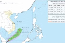
Storm Narra's projected path as of 7:00 on August 22. (Photo: National Centre for Hydro-Meteorological Forecasting)

Storm brings heavy rains to northern Vietnam

Storm Narra, the fourth to hit the East Sea this year, brought strong winds and heavy rains to northern Vietnam on early August 22, with some areas forecast to receive more than 500mm of rain as the storm moves slowly over the northern waters of the East Sea.

A view of the meeting between Phu Tho authorities and a visiting delegation from Germany's KfW Development Bank in the province on August 20, 2026. (Photo: VNA)

Phu Tho, German bank discuss wastewater treatment plan for Da River's left bank

The project is being implemented in the former Hoa Binh city, now Hoa Binh ward. It has a total investment of 688.7 billion VND (26.38 million USD), including 507.3 billion VND in ODA and 181.4 billion VND in counterpart funding. Major components include a wastewater treatment plant, pumping stations, a collection network, and connection infrastructure.

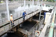
Construction workers reinforce steel and pour concrete to cover the underground drainage channel, helping collect rainwater and tackle flooding in Da Nang. (Photo: VNA)

A new “shield” against climate change

Smart urban areas are no longer simply about technology; they are becoming a tool that enables authorities to forecast risks, adapt quickly and protect their residents.

Vietnam is exerting efforts to cope with climate change. (Illustrative photo: VNA)

Vietnam approves carbon credit pact with Singapore under Paris Agreement

Signed on September 16, 2025, the Implementation Agreement on carbon credits collaboration under Article 6 of the Paris Agreement on climate change affirms Vietnam and Singapore’s pioneering role and commitment to close cooperation in the international carbon market, making a substantive contribution to global climate response.

A view of Vo Cuong ward, Bac Ninh province (Photo: VNA)

Bac Ninh earmarks over 1.7 billion USD for environmental protection

By 2030, Bac Ninh aims to ensure that all operating industrial clusters and industrial parks have centralised wastewater treatment systems meeting standards, while at least 95% of wastewater in Grade-I urban areas and 70% in Grade-II urban areas is collected and treated to required standards.

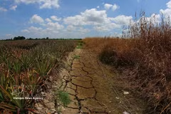
Many inland canals in Can Tho city dries up following a prolonged period of extreme heat. (Photo: VNA)

Government adopts action programme on environmental protection, climate resilience

The programme aims to translate the Party's orientations into concrete actions while strengthening environmental governance, enhancing climate resilience, and promoting a green, circular and low-carbon economy. It will serve as the basis for ministries, sectors and localities to formulate implementation plans for the 2026–2030 period, with a vision to 2045.

Dray Sap Waterfall lies within the UNESCO Dak Nong Global Geopark in Nam Da commune, Lam Dong province. (Photo: VNA)

Lam Dong steps up efforts to retain UNESCO global geopark status

Covering nearly 4,760 square kilometres across 22 communes and wards in western Lam Dong (equivalent to 73.1% of the former Dak Nong province's natural area), the geopark was shaped by millions of years of geological activity and successive volcanic eruptions.